My Experience With Hiking Apps
In 2018 I did my first trip to western Canada. Visiting Banff planted the seed in what would make me a hiker. Since then I’ve spent a fair bit of time around the Toronto area continuing to do more trails. I’ve gone up to the Bruce Peninsula, done hikes in Scotland, and been back to Banff as well. With all this I ran into All Trails which is probably the biggest online hiking community, at least that I am aware of. I mainly used it to find trails, but never used the paid version or looked at offline map support. This year I decided to change that.
All Trails Experience
Primarily when I would look up a trail, I’d pull it up on the All Trails app on my phone. If I were to lose signal, the map would still stay visible for me unless I was disconnected for a long time. The GPS still functions of course, so long as I had the map I was pretty good to go in terms of completing the hike successfully. Thankfully in Banff since I’m going up mountains there’s usually only one way to go, so it’s pretty straight forward to keep a sense of direction.
Here’s an example of what I would be following in the app:
In 2023 I took a trip in October up to around Killarney and then North Bay. One hike I did in Killarney has a section where it’s made up of a lot of smooth rolling rocks. Meaning not only is it slippery, and therefore dangerous to get lost, there’s no identifiable foot path. They have markers around, but it can be easy to lose your way. This is where a lack of precision in my method of navigating started to show its face.
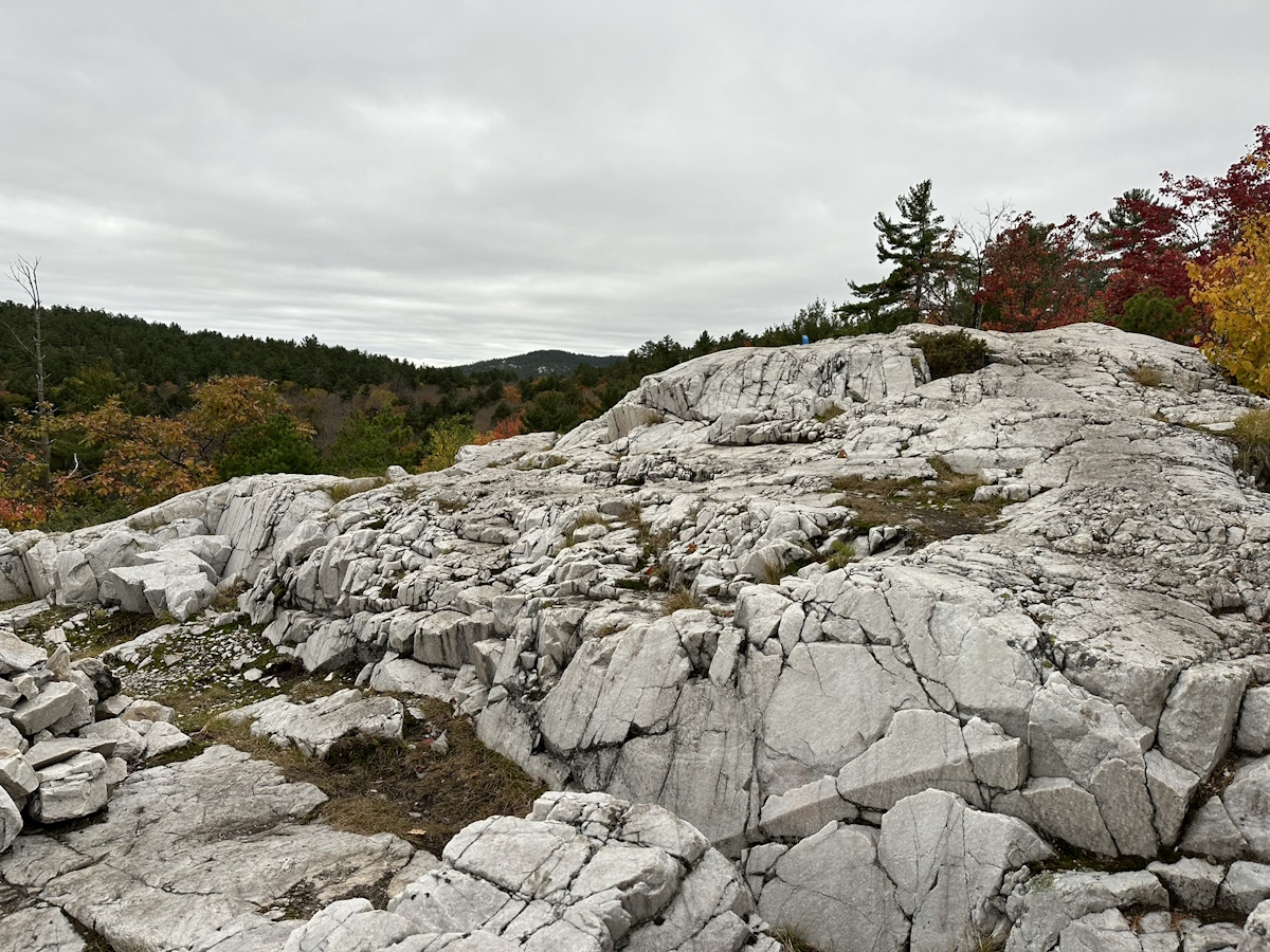
Pictured above is a view of the rolling white bedrock in the La Coche mountains of Killarney
A hike I then did in the North Bay areawas through a lovely set of hills, especially in the Fall colours. However as I was around half way through the hike I lost the trail as it became completely covered in the leaves that had fallen already. One can usually figure it out by feeling the toughness of the path through their feet, or by looking for where there’s no growing bush. But due to the nature of the forest I was in, there was no easy way to tell. I completely lost track of the trail. While I did check the map in All Trails, I felt like the lack of real time GPS could’ve been a factor here. To be fair to All Trails it could’ve also been a MapBox data issue, where the trail path is out of date.
This leads me to this year, and checking out David Smith’s Pedometer++ app.
Pedometer++
David added features to his app in 2023 that opens it up for hiking. Most importantly it allows you to create your own routes, and store them offline. These are paid features in the app, so you do need to have a subscription. But I decided to give it a go, using a free trial of it before going on a hike. I created the route I was going to do, and used the app on my phone through the hike. I was instantly hooked. The route planning UI has the path snap to the trail routes that come through the Map Box data. It’s easy to search to jump around to different locations to plan maps out. I’d search cities, towns, park names, etc. I used it all for my time hiking in the UK this summer as well.
It became very helpful with more complex routes like the one here in Nakkertok, Quebec. Where the path is very windy and there’s lots of intersecting trails.
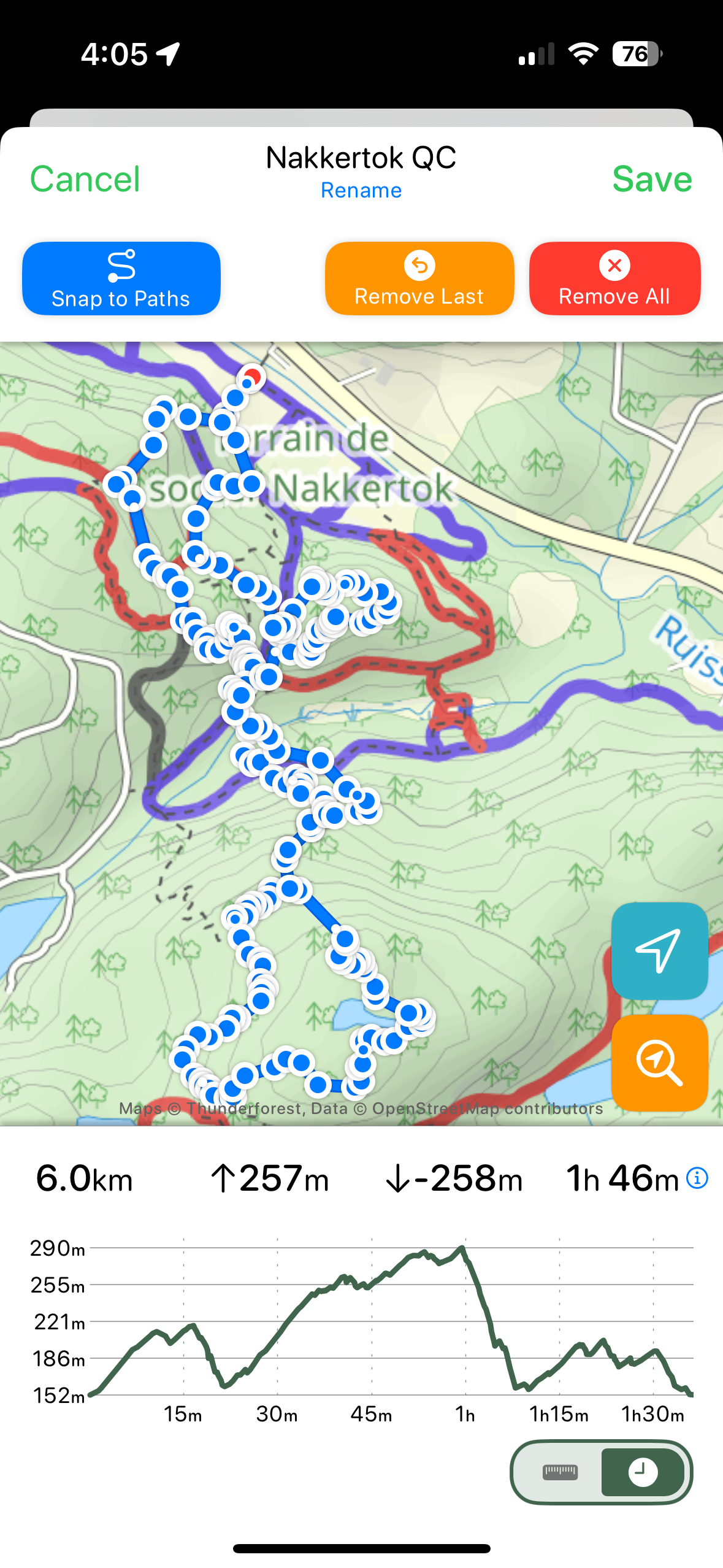
Photo of route planned for Nakkertok Park
As I would go out for a hike I would download the map to ensure I have it irregardless of signal quality. Once I arrived at the trailhead I would then start the workout through the app on my Apple Watch Ultra (yeah I’m an apple nerd). This workout will sync with the Health app; tracking calorie burn, time speant, elevation gained, etc. It shows a real-time map of me going along the trail, making it easy to keep track of my location and direction.
It of course can’t solve every navigational problem. Trails with a lot of back and forth switch backs can still be a little tricky. Or when the trail just straight up disappears, like in a boggie area of The Peak District that will remain nameless. But beyond that I love the experience of using this app on my hikes.
With this though, I am having to manually plan out each route, even though I still use All Trails to look them up in the first place. This takes me into trying All Trails+ for when I did some hiking in Quebec.
All Trails+
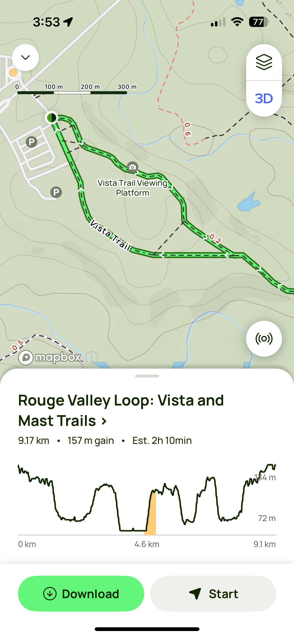
All Trails+ is their paid subscription version of the app. It allows you to do a number of things, but what I was looking to try was to download offline maps, and use their real time directions.
The first hike I tried this out for was at Mont Sainte-Marie. Though I had forgotten to install the watch app ahead of time. Which meant I would just be using my phone to look at the map as I go along. The real time tracking on their works great, it shows you an angled map, kinda similar if you use Maps directions while driving. It’ll buzz you if you start really going off trail. And you can still see other branching paths near by if you want to change or extend your hike in someway. My experience on using the app during the hike was great. Especially since I had to re-route around a closed part of the trail and find another way through.
The hike took me around 3 hours. When I got back to my car, I was in for a bit of a surprise: I was left with 5% battery, on an iPhone 14 Pro!
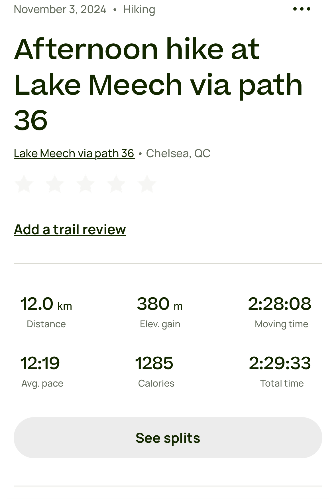
Using Pedometer++, I never ran into this kind of battery consumption. Though I knew that this wasn’t entirely a fair comparison, as I use the watch app with Pedometer++, not so much the phone. A couple of days later I did a hike in Gatineau Park, and setup the watch app ahead of time. Similar to Pedometer++ it would track a workout during this time, capturing all sorts of useful & fun data, which can sync with your Apple Health data if you choose.
Though what it did lack was a real time map on the watch. During this hike I would still pull out my phone occasionally to check the map, but not as much since the watch app will show you a compass. Although I found whenever I’d raise my watch it would tell me im going the wrong way for a second or two, and then correct itself.
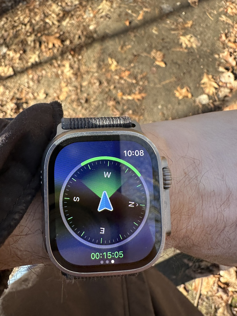 .
.
Since the compass doesn’t show a great degree precision and it has this delay effect, I worry that this would make it rather difficult to navigate a compact & windy trail. Because this particular trail was easier to follow, I found myself not having to look at my phone for the map as much anyways, but my battery life on this hike was much more acceptable. Both my watch & phone lasted until bed time.
Conclusions
Given that the features I want from these apps are behind pay walls, and are the same price, it’s really about preference as to which one I choose. I really like the live map data on my watch that Pedometer++ gives me, and it doesnt kill my battery when I need to look at the map constantly. Right now I am very much leaning towards using that full time, and just using All Trails as a social network to find routes to do. Though if All Trails were to add a live map on the watch that was pretty efficient on battery usage, I would definitely give it another shot.